
Typhoon season 2014 - 台風情報
. . source : typhoon.yahoo.co.jp
source : Japan Meteorological Agency
:::::::::::::::::::::::::::::::::::::::::::::::::::::::::::::::::::::::::::::::::::::::::::::::::::::
Typhoon Nr. 08 台風8号
NEOGURI(ノグリー)
4日09時に台風第08号が発生しました。
4日9時にはマリアナ諸島にあって、北西へ毎時30kmで進んでいます。中心気圧は998hPa、中心付近の最大風速は18m/sです。この台風は、5日9時にはフィリピンの東に達し、北西へ進むでしょう.
It will come up and change direction, heading toward Western Japan on the 9th or 10th . . .

2014年7月5日16時30分発表
5日15時にはフィリピンの東にあって、北西へ毎時25kmで進んでいます。中心気圧は955hPa、中心付近の最大風速は40m/sです。この台風は、6日15時にはフィリピンの東に達し、7日15時には沖縄の南に達する見込みです。
Heading toward Western Japan after all . . .

2014年7月6日10時30分発表
大型で非常に強い台風第08号は、6日9時にはフィリピンの東にあって、西北西へ毎時30kmで進んでいます。中心気圧は940hPa、中心付近の最大風速は45m/sです。この台風は、7日9時には沖縄の南に達し、8日9時には那覇市の南南西約180kmに進む見込みです。
9日9時には東シナ海に達するでしょう。
at 15:00

.......................................................................
2014年7月7日

. 雨の日に 雨の音との 三昧よ .
and at 9:00 it has dropped further south,
leaving Okayama on the northern side

2014年7月7日10時30分発表 at 10:30
大型で非常に強い台風第08号は、7日9時には沖縄の南にあって、北西へ毎時20kmで進んでいます。中心気圧は930hPa、中心付近の最大風速は50m/sです。この台風は、次第に進路を北よりに変えて東シナ海を北上し、10日9時には九州の西に達するでしょう。
The circle of very strong wind is about 200 km.
暴風域 - 中心から200km
2014年7月7日16時30分発表 at 16:30
大型で非常に強い台風第08号は、very large and very strong
7日15時には沖縄の南にあって、北西へ毎時25kmで進んでいます。中心気圧は930hPa、中心付近の最大風速は50m/sです。この台風は、次第に進路を北より変えて、8日15時には宮古島の北北東の海上に進み、東シナ海を北上して、10日15時には九州付近に達するでしょう。
.......................................................................
2014年7月8日
2014年7月8日4時30分発表
大型で非常に強い台風第08号は、8日3時には宮古島の南東約150kmにあって、北北西へ毎時30kmで進んでいます。中心気圧は930hPa、中心付近の最大風速は50m/sです。この台風は、9日3時には東シナ海に、10日3時には九州の西に、11日3時には四国に達するでしょう。
最大瞬間風速 70m/s
Will be south of Kyushu on the 10th and head toward Shikoku on the 11th.

All day was hot and humid like in the sauna outside.
NHK news
Typhoon Neoguri bringing gusts, rain to Okinawa
Powerful Typhoon Neoguri is bringing heavy rain and strong winds to Japan's southernmost prefecture of Okinawa.
Japan's Meteorological Agency says the typhoon was located 260 kilometers north-northwest of Kumejima Island as of midnight Wednesday. It is moving northward at 25 kilometers per hour.
The typhoon has a central atmospheric pressure of 945 hectopascals. Its maximum wind velocity is more than 210 kilometers per hour.
Parts of Okinawa's main island are under a storm zone.
Winds of nearly 120 kilometers per hour were observed in the Amami region of Kagoshima Prefecture on Tuesday evening.
The agency issued emergency warnings for strong winds, high waves and heavy rain for Okinawa's main island.
The island could experience winds of 180 kilometers per hour. Waves of 13 meters could hit the coast.
Weather officials say gusts of more than 120 kilometers could blow in Kyushu and the Amami region on Wednesday. Rough seas are also expected.
A warm, damp air mass brought by the typhoon is likely to cause localized heavy rain across Japan.
Total rainfall by Thursday could reach 500 to 700 millimeters in some parts of Kyushu and Shikoku.
Weather officials are urging people to stay on the alert for mudslides, floods, lightning strikes and gusts even if their regions are not in the path of the typhoon.
Jul. 8, 2014
.......................................................................
2014年7月9日

2014年7月9日4時30分発表
大型で強い台風第08号は、9日3時には東シナ海にあって、北へ毎時20kmで進んでいます。中心気圧は960hPa、中心付近の最大風速は35m/sです。この台風は、このあと東シナ海を北上し、10日3時には九州の西に達するでしょう。その後、東よりに進路を変え、11日3時には四国沖、12日3時には関東の南東に達する見込みです。
Now it is coming up north again . . . at 15:00

2014年7月9日16時30分発表
9日15時には九州の西にあって、北東へ毎時30kmで進んでいます。中心気圧は970hPa、中心付近の最大風速は30m/sです。台風は、このあと東よりに向きを変え、10日3時には福江島の南南西約70kmに達する見込みです。その後、10日15時には延岡市付近、11日15時には茨城県を通り、温帯低気圧に変わって、12日15時には北海道の東に達するでしょう。
速さ -30km/h
NKH, news Jul. 9, 2014 - Updated 10:44 UTC
STS Neoguri moving east off Kyushu
Severe tropical storm Neoguri is moving east over waters off Japan's southern island of Kyushu.
Neoguri, which was downgraded from a typhoon on Wednesday afternoon, still packs strong winds and is expected to bring heavy rain.
The Japan Meteorological Agency says the storm is approaching Kyushu and is likely to make landfall on Thursday.
Agency officials say the storm was over the East China Sea west of Kyushu at 7:00 PM on Wednesday, and moving east at 15 kilometers per hour.
Its central atmospheric pressure was 970 hectopascals, with a maximum wind velocity of about 110 kilometers per hour.
Japan's southernmost prefecture of Okinawa has had record rainfall of 300 millimeters in a 12-hour period -- double the average for July.
The Meteorological Agency says heavy rain of up to 80 millimeters per hour is expected over much of Japan through Thursday.
The storm has left at least one person dead and 38 others injured.
As of 6:00 PM Wednesday, 2 homes had been destroyed and 212 damaged. 296 homes were flooded.
Evacuation advisories have been issued for nearly 23,000 households. 28,400 households have been left without power.
Kyushu Japan Railway says bullet train services between Kumamoto and Kagoshima will be suspended on Thursday.
.......................................................................
2014年7月10日
2014年7月10日4時30分発表 . . . at 4:40
台風第08号は、
10日3時には天草市の西南西約100kmにあって、東へ毎時20kmで進んでいます。中心気圧は975hPa、中心付近の最大風速は25m/sです。この台風は、10日15時には高知市の南南東約70kmに、11日3時には静岡市付近に達する見込みです。その後、温帯低気圧に変わり、12日3時には根室市の北西約30kmに達する見込みです。
It is loosing strength and the very strong wind circle is gone. only "strong wind"
強風域 (15m/s以上) : 南東側600km / 北西側390km

:::::::::::::::::::::::::::::::::::::::::::::::::::::::::::::::::::::::::::::::::::::::::::::::::::::
. TYPHOON SEASON 2013 .
. TYPHOON SEASON 2012 .
. TYPHOON SEASON 2011 .
. TYPHOON SEASON 2010 .
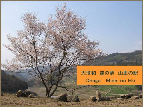
大垪和 。。。道の駅に戻る – Michi no Eki - BACK
岡山県美咲町大垪和西
:::::::::::::::::::::::::::::::::::::::::::::::::::::::::::::::::::::::::::::::::::::::::::::::::::::


No comments:
Post a Comment